Plan greener cities
Provide feedback to inform new features!
Urban tree canopy is being lost all around the world.
Developers and governments deserve a consistent and reliable way to demonstrate the effectiveness of proposed canopy cover, shading, and urban heat reduction.
Features you'll love,
with more to come
Sun light modelling
Species-based growth
Export options
Map-based editor
Local tree selections
Professional reporting
Try a demo below to see how it works

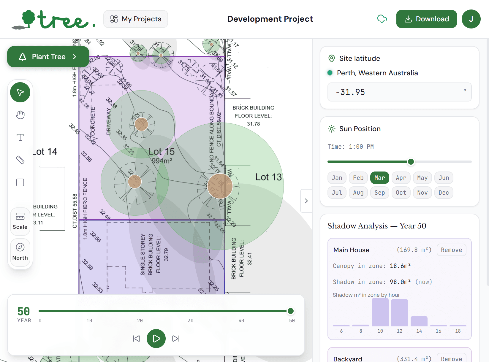
Shadow Analysis — Year 20
Shadow area mapping
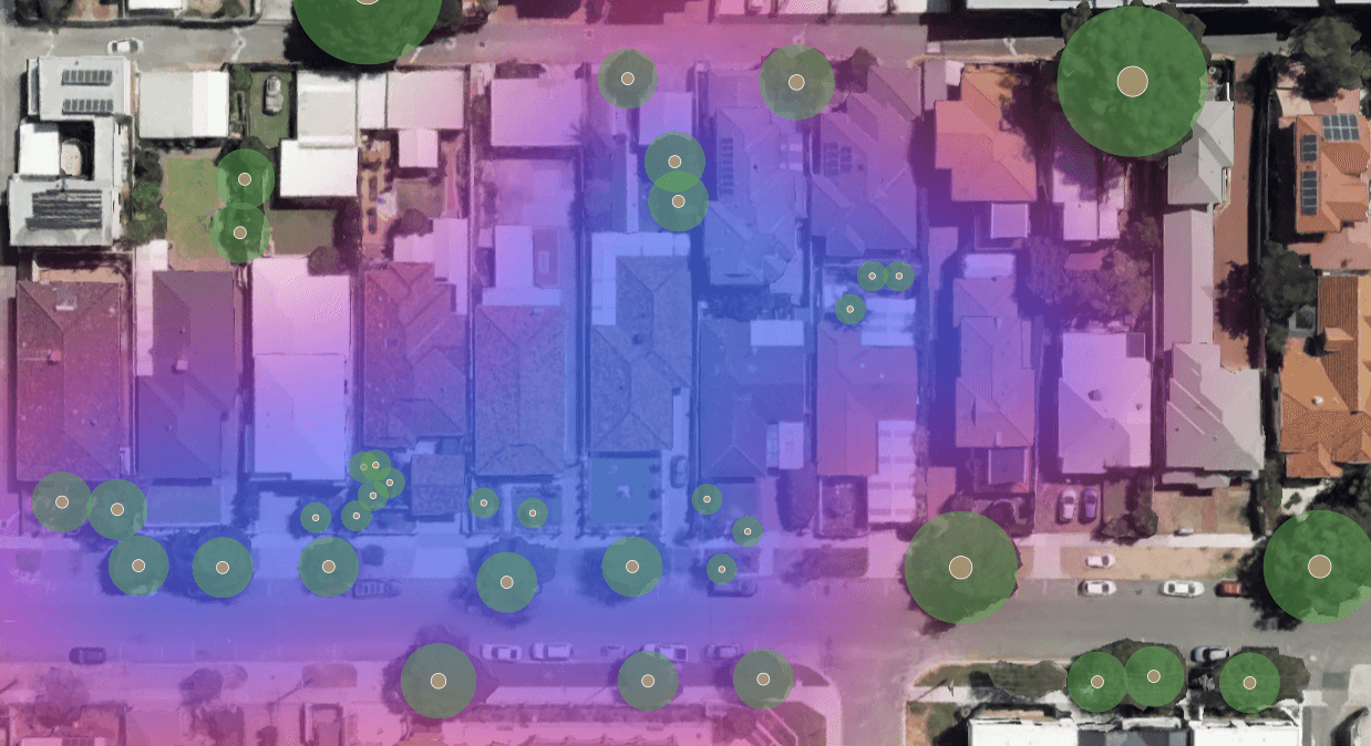
Tree uses latitude, month and time to track solar movements and measure shadows, producing an accumulated shadow map that shows which areas receive the most shade. Define your own analysis areas, like a pedestrian path, playground, or neighbouring property and get precise shade calculations for each.
Performance Metrics
Carbon Sequestration
2,365kg/year
Species
Brushbox
Jacaranda
Tuart
No.
12
5
2
Height
20
10
22
Trunk Dia.
80cm
80cm
150cm
Carbon sequestration calculations
Tree estimates annual and cumulative carbon sequestration for each placed tree based on species, age and canopy size, and using biomass coefficients drawn from Australian forestry research. The running total across your entire planting scheme gives planners a defensible carbon contribution figure for inclusion in environmental reports and sustainability assessments.
Urban Heat Island
Average Cooling
->
-2.7°C
8am - 6pm
Peak Cooling
->
-8.1°C
Best minute
Urban heat island reduction
More canopy cover helps reduce surface and ambient temperatures through evapotranspiration and direct shading. Tree estimates the localised cooling effect of the canopy in degrees Celsius, and provides an average and peak cooling figure. Heat map visualisation coming soon!
Security from the ground up.
Development site plans contain commercially sensitive information. Tree is built to meet the data handling expectations of planning professionals and government procurement.
Uploaded plans are private by default
Every site plan you upload is stored against your account only. Plans are never shared, indexed, used for training, or accessible to other users or organisations. Deleting a project permanently removes all associated files.
Encrypted in transit and at rest
All data is encrypted in transit via TLS and encrypted at rest via Supabase's managed infrastructure, hosted on AWS in the Sydney region.
About me!

Hello 👋
I'm Jordan and I built 🌳tree to help you plan and understand canopy and shade cover at your house, along a street or across a whole suburb.
I hope this tool can help get more trees in new developments, highlight the importance of trees in our communities, and also be a fun way to experiment with planting and growth patterns.
Please give 🌳tree a try and let me know what you think!
Contact me for questions or feedback:
I want to build more cool apps. Let me know if you've got a great idea and maybe we can work together to make it a reality!
Tree is open and free for feedback purposes
Upload a plan, place a tree, and run your first shadow simulation in under five minutes.